Travel Guide of Monte Altissimo di Nago in Italy by Influencers and Travelers
Monte Altissimo di Nago is one of the highest summits of the Monte Baldo mountain range and thereby part of the Garda Mountains in northern Italy.
Download the Travel Map of Italy on Google Maps here
Pictures and Stories of Monte Altissimo di Nago from Influencers
8 pictures of Monte Altissimo di Nago from Cristina Gottardi, Greta Farnedi, and other travelers
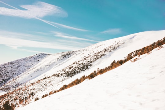
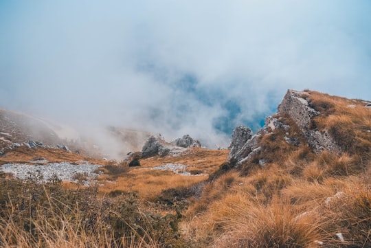
- Green mountains and clouds ...click to read more
- Experienced by @Cristina Gottardi | ©Unsplash

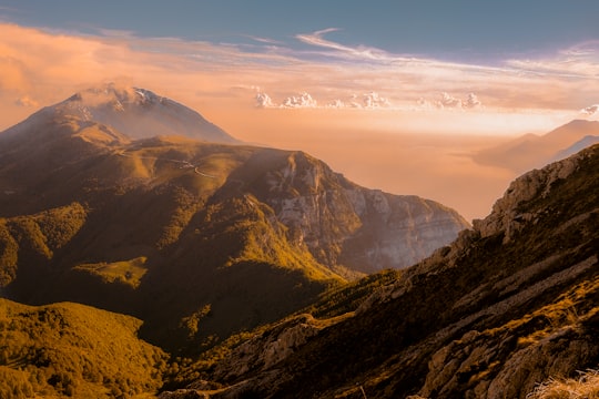
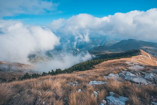
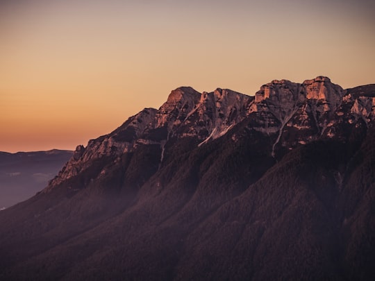
- Orange mountain clouds ...click to read more
- Experienced by @Cristina Gottardi | ©Unsplash


Plan your trip in Monte Altissimo di Nago with AI 🤖 🗺
Roadtrips.ai is a AI powered trip planner that you can use to generate a customized trip itinerary for any destination in Italy in just one clickJust write your activities preferences, budget and number of days travelling and our artificial intelligence will do the rest for you
👉 Use the AI Trip Planner
Book your Travel Experience at Monte Altissimo di Nago
Discover the best tours and activities around Monte Altissimo di Nago, Italy and book your travel experience today with our booking partners
Map of Monte Altissimo di Nago
View Monte Altissimo di Nago on a map with the the closest popular places nearby
Download On Google Maps 🗺️📲
More Travel spots to explore around Monte Altissimo di Nago
Click on the pictures to learn more about the places and to get directions
Discover more travel spots to explore around Monte Altissimo di Nago
⛰️ Hill spots ❄️ Glacial landform spots ⛰️ Hill station spots ⛰️ Mountain range spots ⛰️ Mountaineering spotsLearn More about Monte Altissimo di Nago
The Altissimo is the main peak of the northern part of the Monte Baldo range, which extends approximately from north to south. Other important mountains in the range are the Punta Telegrafo in the south and the highest peak in the range, the Cima Valdritta. The Bocca di Navene saddle separates the southern and northern parts.
On the mountain, there is different climatic zones. Thanks to its characteristic and variable landscape as : the Mediterranean climate; from 700 m to 1500 m, the boreal climate up to 2000 m and the alpine climate over 2500 m.
The higher you go, more you will find this kind of climate and temperature.
Monte Altissimo di Nago is a good place for hiking trails though mountains. It will bring you good feelings. Don't forget to take with you what you need to climb the mountain in the cold because Monte altissimo is very high.
Frequently Asked Questions by Travelers planning a trip to Monte Altissimo di Nago
The higher point of Monte Altissimo di Nago is
Where to Stay near Monte Altissimo di Nago
Discover the best hotels around Monte Altissimo di Nago, Italy and book your stay today with our booking partner booking.com
Popular destinations near Monte Altissimo di Nago
Disover the best Instagram Spots around Monte Altissimo di Nago here


San Pietro in Cariano
34 km (21.0 miles) away from Monte Altissimo di Nago
Travel guide of San Pietro in Cariano

Castel San Pietro
41 km (25.6 miles) away from Monte Altissimo di Nago
Travel guide of Castel San Pietro


Peschiera del Garda
44 km (27.4 miles) away from Monte Altissimo di Nago
Travel guide of Peschiera del Garda

Desenzano del Garda
46 km (28.5 miles) away from Monte Altissimo di Nago
Travel guide of Desenzano del Garda

Madonna di Campiglio
47 km (29.1 miles) away from Monte Altissimo di Nago
Travel guide of Madonna di Campiglio